
 Current Issue PDF
Culture
Hiking among history: Obsidian Cliffs
By Kamiah Koch
Social media/digital journalist
A cloud of dust from the passing mule-train was still floating in the air when I hiked into a glittering meadow, pausing to look around because nature doesn’t often sparkle this much.
McKenzie River Ranger District Archaeologist Tim Fox explained, “This pavement is all tool making.”
According to Fox, the thick layer of obsidian flakes covering this site is due to early Native Americans coming here to create their tools.
Obsidian flakes seen Tuesday, Aug. 11, at a lower-elevation section of the Obsidian Trail, left here by generations of Tribal people knapping obsidian to create bifaces which could be traded and turned into various tools like arrowheads and scrapers. (Photo by Kamiah Koch)
To many, this may seem unremarkable. However, it gave me goosebumps because I was imagining the people who left behind these obsidian flakes. It’s not often you come across the “footprint” of your ancestors.
Beginning in the early 2000s, the Grand Ronde Tribe’s Historic Preservation Office has been organizing trips to get Tribal members and staff out into culturally significant locations in Oregon as an ongoing effort to share the importance of protecting these places. One of these historic places is the Obsidian Cliffs, located 150 miles southeast of the Grand Ronde reservation and tucked below the west side of the North Sister mountain.
“Since we’ve started doing the trip again in the 2020s, we’ve tried to include different staff, community and partners over the last five years so we can broaden the number of people who can visit the Obsidian Cliffs,” Tribal Cultural Protection Coordinator Cheryl Pouley said in an email.
As a Grand Ronde Tribal member and Smoke Signals staff member, I joined this year’s 11.5-mile roundtrip hike to the Obsidian Cliffs for a three-day adventure.
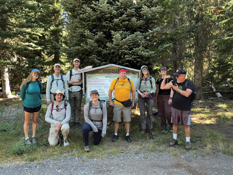
The Confederated Tribes of Grand Ronde’s 2026 Obsidian Cliffs group photo was taken at the Obsidian Trail trailhead Tuesday, Aug. 11, and included Tribal members, Tribal staff and U.S. Forest Service staff. (Photo by Kamiah Koch)
Before we began hiking, Pouley and Tribal Cultural Protection Specialist Chris Bailey asked me what I was looking to get out of this trip as Tribal member. I told them I had basic knowledge of the Obsidian Cliffs but I was looking to deepen my “connection to place,” a phrase I hear often in the Tribal community.
Our group of 10 departed from the Obsidian Trailhead Tuesday, Aug. 11. The trail has a challenging 2,100 feet of elevation gain but offers dense conifer forests draped in lime-green moss, rugged ancient lava flows and orange California tortoiseshell butterflies fluttering around stream crossings to distract you from the pain.
Within the first hour of hiking, we came across a small piece of obsidian sitting in the middle of the trail. By the second hour we crossed the first field of obsidian flakes. Fox and Pouley used the pieces of obsidian we observed along the trail to teach me how to identify if a biface has been worked on by a human. I began looking for the bulb of percussion (a small mound formed when obsidian fragment is struck off a larger piece) and small, uniform edge chipping (for sharpening).
When we reached the site where we would be camping, adjacent from the obsidian quarry, it was hard to avoid the signs that for thousands of years people have spent time here.
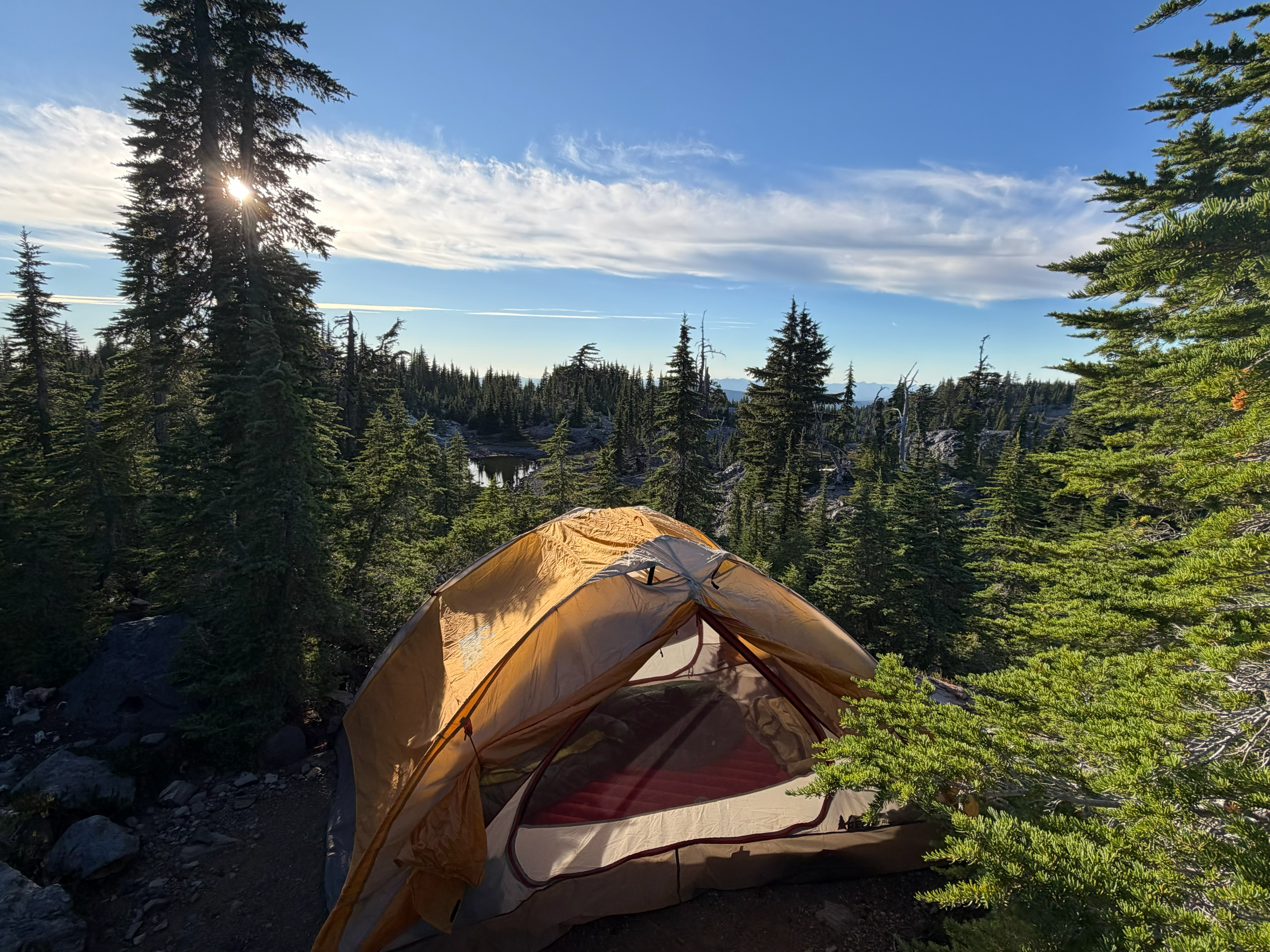
Tribal member and Social Media/Digital Journalist Kamiah Koch’s tent site overlooking a small pond and the obsidian quarry. The Grand Ronde Historic Preservation Office organized this trip for Tribal members, staff and Forest Service staff to spend three days exploring the Obsidian Cliffs. (Photo by Kamiah Koch)
Besides the designated tent spots, the quarry area was dominated by sharp palm-sized chunks of obsidian. Now knowing what to look for, I searched for knapped pieces and spent a lot of my relaxation time imagining the people who left behind these razor-sharp fragments. (I unwisely wore open-toed shoes to walk around my camp but only sustained one minor cut).
The Obsidian Trail attracts lots of hikers and thru hikers on the Pacific Crest Trail, which overlaps the Obsidian Trail at Obsidian Falls. I saw roughly 100 hikers traversing this area during our trip, and of the handful I talked to, none of them knew the cultural significance of the cliffs. They all expressed interest in the history of this place, but for most it was just a resting spot and water resupply in their longer journey. I felt lucky that our trip allowed multiple days to explore this area as my ancestors may have.
On day two, we hiked the ridge above Obsidian Cliffs, unofficially known as Arrowhead Lake. Unfortunately, due to low snowfall levels this year, it was more puddle than lake.
However, beyond the lake were amazing vista views of the surrounding ridgelines. Fox pulled out a map to demonstrate what ridgeline routes would have been traveled to reach Obsidian Cliffs. I was surprised when he pointed to far off ridgelines barely visible in the distance. The abundance of obsidian here attracted Indigenous people from far and wide.
McKenzie River Ranger District Archeologist Tim Fox stands at the Arrowhead Lake vista Wednesday, Aug. 12, and uses a map to trace the travel routes early Indigenous people used to reach the Obsidian Cliffs below. (Photo by Kamiah Koch)
A research article on ancient trade routes from the University of Oregon’s Museum of Natural and Cultural History Director of Research Thomas Connolly finds that obsidian tools were predominately taken north for use and trading.
“Obsidian Cliffs obsidian has been found at many archaeological sites, particularly in western and central Oregon, and it is clear that this was a major toolstone source throughout the post-glacial period,” the article stated.
Fox said something similar while we were standing above the Obsidian Cliffs. According to Fox, obsidian from these cliffs has been found as far as British Columbia.
How could they possibly know where a tiny piece of volcanic glass formed from the numerous volcanos along the Cascade Mountain range? Fox informed me they use X-ray florescence to find unique “elemental fingerprints” which allows them to locate the origins of the obsidian. From this and obsidian tools they find miles away, they can map the trade routes of early ancestors. From the vantage point we were standing at almost 7,000 feet, I could see it.
We continued to hike around the cliffs, entering another meadow where toolmaking was evident by the flakes strewn across the field. At the top of a tall rock feature someone named Eagle’s Rest, we found more obsidian flakes. I again imagined the person who presumably carried their obsidian up here. Did this bluff have a ceremonial purpose or did they just like the view?
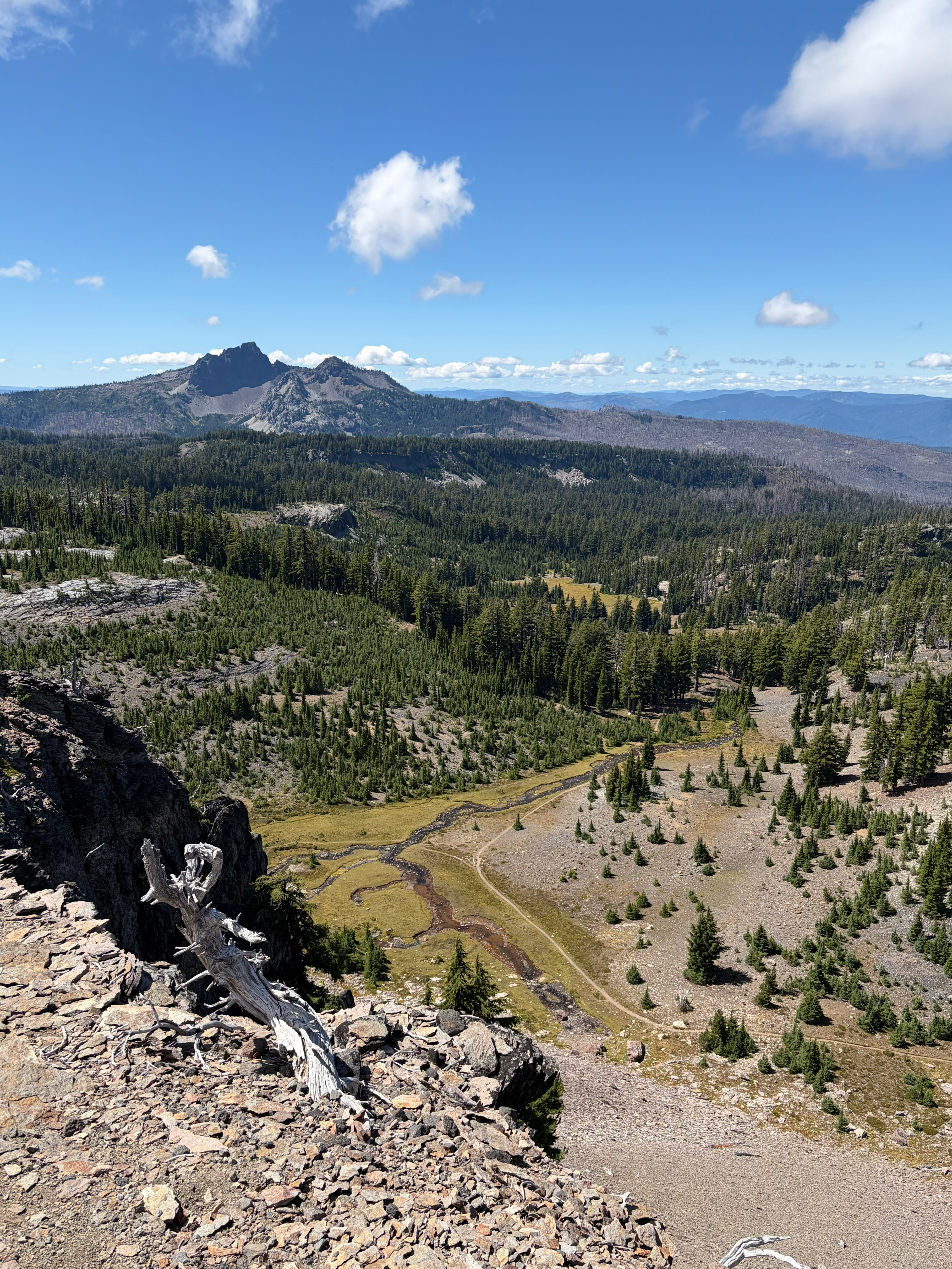
Another view from Arrowhead Lake’s vista, looking southwest. Below is the start of the Sister Spring, Eagle’s Rest and the Husband Mountain. (Photo by Kamiah Koch)
A lot of knowledge and history about this place was lost when white settlers arrived, Tribal people were forcefully removed to reservations and the Grand Ronde Tribe was terminated by the U.S. government. However, against all those odds, and with the aid of CH Packstring’s mules, a handful of Tribal people are returning to the Obsidian Cliffs to learn and revitalize the practice of obsidian tool making.
On day three, we packed up and began our hike back down the trail. On the way out we passed the quarry, a large hunk of obsidian protruding from the ground. Chunks and flakes covered the ground, and a crunching glass sound was heard with every step I took. As we hiked away from the Obsidian Cliffs, the thick layer of flakes we were stepping on began to dissipate. Soon it was just a few flakes speckling the dusty path. We descended into the lava flows and dense forest, which were beautiful, but they lacked the sparkling obsidian my eyes had grown accustomed to.
I went on this Tribally sponsored trip looking for a better connection to the wilderness area and to learn about its cultural significance by experiencing it myself. I feel I discovered that and more. Although we’ll never know who the people were knapping the obsidian in the meadows or on top of Eagle’s Rest, to have Tribal people returning to this place to walk in their footsteps feels pretty special. I ended this trip with a deeper connection to place and to my people.
Koch standing on top of the obsidian quarry Thursday, Aug. 13. This abundant source of obsidian historically brought Indigenous people here to gather volcanic glass for tool making. (Photo by Kamiah Koch)