Culture
GIS Analyst Alex Drake is named Tribe's first drone pilot
Blending ancient values with new technology continues to permeate throughout every program the Grand Ronde Tribe has created for the benefit of the membership.
The latest blend of old and new to benefit the Tribe is the purchase of a drone by the Cultural Resources Department.
On Tuesday, April 11, Tribal GIS Coordinator Volker Mell and GIS Analyst Alex Drake presented information to Tribal Council at its regular Legislative Action Committee meeting about Drake becoming licensed through the Federal Aviation Administration to become a remote drone pilot.
Mell and Drake work for the Tribe’s Geographic Information Systems program, which provides a critical tool for Tribal planning and strategic missions.
Tribal Council gave final approval for Drake to become the Tribe’s first Unmanned Aircraft Systems pilot at its Wednesday, April 19, meeting.
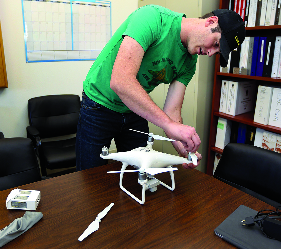
The drone, which is now registered with the FAA, was purchased for about $1,200 by the Cultural Resources Department and will be flown only by Drake and will be housed in the Tribe’s Cultural Resources Department.
The DJI Phantom 4 Quadcopter drone will be used for Natural Resources Department projects, as well as the Cultural Resources program.
Mell said he got the idea of using a drone for information gathering that could be useful to the Tribe many years ago when the technology was first being introduced to the private market. He said the cost of drones in the early days of the technology were as much as $80,000 and over the years the price has decreased to about $20,000.
Even when the drones were in the $20,000 range, Mell said he knew they were out of the Tribe’s price range.
Mell said he was attending a conference of the North West Tribal GIS User Group in the state of Washington when he heard more about how Tribes were using drones for information gathering on their lands and in their usual and accustomed areas.
Mell said the people at those meetings had gone from laughing at the thought of ever being able to afford drones to seeing it actually working. Mell said they were shown what the drone could do.
“I was really impressed,” Mell said. “We looked at what we needed. Alex and I researched it. We researched different software options and different drone options and different applications that the Tribe would have.
“We figured out by doing our research that even with these little hobby drones it can deliver the same imagery that we are looking for.”
Cultural Resources Department Manager David Harrelson said he loves that the Tribe is using a drone to gather vital information.
“I get excited about the drone,” Harrelson said. “Whether it’s flying timber stands or being able to take localized digital elevation modeling and much better mapping so that the detail will exist from this drone or whether it’s looking at vegetation patterns or it’s looking at elevation models, I’m excited to see how the drone can be used.”
Harrelson said he is happy to receive support from Mell, Drake and the GIS program.
“The drone being used by GIS is a really good fit because GIS is one of our support programs here at the Tribe that supports numerous departments,” Harrelson said. “You have this shared investment in a drone that can be utilized for survey activity. When we buy these resources that are able to be utilized by multiple programs they have the ability to pay for themselves rather quickly.”
Drake said he is as excited as Harrelson to get started and he has had his remote drone pilot’s license since October 2016. Private remote drone pilot’s licenses only became available in August 2016.
“It makes me feel good that I can help out and provide maps for culture,” Drake said. “I’ll be providing them with maps and we can also do 3-D models.”
Drake said the first test flight will occur over the Governance Center building. He said he will fly a test pattern using an app downloaded on to Drake’s cell phone.
“Drone Deploy” is a free app Drake and Mell downloaded that will take over the flight once it is in position.
“We’re going to test it out here at the Governance building and we’re going to make a map of the Governance building to see what the software can do,” Drake said. “The way I set up the mission in the mission planner it basically tells the drone to fly this grid pattern and take pictures every so often to overlap the photos.”
All the people involved in the drone flight project want local Tribal members to know that they are only gathering information for mapping purposes and all images captured are straight down aerial photographs.
“When we are taking images, the camera is always pointing directly down,” Mell said. “The images that we are getting won’t show any faces of people. We’re not interested in that. All the pictures are straight down and we stitch them together. This is for mapping. It will make life easier.”
Mell said he is proud of Drake for stepping up, getting his license and wanting to learn.
“He is the pilot in command now,” Mell said. “Whenever we fly for the Tribe and everything that we fly will go through him.”
Drake said he wants to get started as soon as possible and put what he learned to work for the Tribe. He also said he wanted to thank Mell for believing he was the right person to become the Tribe’s first officially FAA-licensed remote drone pilot.
“I’m excited about it, too,” Drake said. “Right now we’re just getting our feet wet. There are so many possibilities that will arise from this.”
Harrelson said he loves the idea of using new technology to help understand the ancient past.
“A part of self-determination is taking who we are and imprinting who we are upon the environment and the new experiences that come forward,” Harrelson said. “That is what is going to preserve us as a people into the future.
“We have the ability to use the drone to document cultural significance for cultural understanding of place and that is significant. It is through our lens and the way that we look at the world so that’s what we’re doing – we’re indigenizing technology.”