Tribal Government & News
Everything's canceled? Then take a hike!
By Danielle Frost
Smoke Signals staff writer
The coronavirus outbreak has meant the cancellation of the Marcellus Norwest Memorial Veterans Powwow in July, Contest Powwow in August, summer youth activities, Canoe Journey, visiting Chachalu Museum & Cultural Center and various family-themed events on the Tribal campus.
So what’s left to do when you’d like the kids to stop playing on their electronics for a while, don’t feel like driving all the way to the beach and want to do something within 20 minutes of Grand Ronde?
Take a hike. Literally.
There are several trails on the Confederated Tribes of Grand Ronde Reservation, which range from easy to challenging. Although several of them are difficult to access at this point due to adjoining roads being closed, there are some that are available.
All are free to visit as there are no parking fees. Smoke Signals staff visited four of these trails and have included a map, photos and videos to help in planning your hiking adventure.
As with any hike, make sure to wear sturdy, closed-toes shoes, dress appropriately, carry water and insect repellent, and bring your phone or camera to take photos and document your adventures.
3.1 mile walking loop: This is an easy, mostly flat route which includes pavement, gravel roads and concrete sidewalks. It is family-friendly.
Begin at the Tribal Health & Wellness Center. Walk along A Ackerson Road. When the road ends, take a right and walk by the Veterans Memorial and Tribal Governance Center.
Take a left when you see the Adult Education Building and continue past the Tribal gym. Take another left and walk by the softball fields before continuing right on a gravel road that will lead you past the Tribal cultural area, rodeo grounds and to the day use park.
Walk the loop at the park and explore Agency Creek, or stop and have a picnic lunch at one of the shaded table areas. Continue left up a gravel road just past the bathrooms and follow until it turns into Blacktail Drive. There, you will see the Elders Activity Center on your left and Elders Housing straight ahead. At Grand Ronde Road, take a right and then a left at Tyee Road, which will put you in Tribal Housing. Walk the perimeter of housing, then back down Tyee Road and a left at Grand Ronde Road. When you arrive back at the Health & Wellness Center, you will have completed your 5K.
Natural Resources Department half-mile trail: This is a single track, mostly flat dirt trail with wood planks in some areas where it becomes muddy. Long pants/shirts with sleeves are recommended due to thick foliage along some parts of the trail, along with hiking shoes or boots if you have them. It is a relatively easy trail to walk, but it is not stroller-friendly.
Park at the Natural Resources Department, 47010 S.W. Hebo Road. Walk behind the Natural Resources office and you will see an entrance. It is unmarked, but clearly visible. The trail is shaded, so it’s a nice place to visit when it gets hot. You’ll be treated to views of wildflowers, as well as the sights and sounds of various wildlife.
Turn around when you come to tall grass and barbed wire fence. A “Y” in the road leads to two paths, both of which take you back to Natural Resources.
Tillamook West six-mile trail: UPDATE: This trail has been cleared recently and is now fully open to hikers without the need for brush cutters.
To reach the trail, head north on Grand Ronde Road past Highway 22 and continue for approximately two miles until you see a stop sign. Make a right onto Southwest Agency Creek Road. Continue on this paved, winding road for approximately 5.5 miles and follow signs for Big Buck campground. There is a small sign for the trailhead on your right-hand side 100 meters past a large gravel clearing on the left. The drive itself is half the adventure, and features forest and creek views.
A map of the area is available by downloading the ESRI Collector Application. For more information about the ESRI Collector app, contact Alex Drake at alex.drake@grandronde.org. To download the app, visit the Google Play icon on Android-based phones and the App Store icon for Apple phones, and type in “ESRI Collector.”
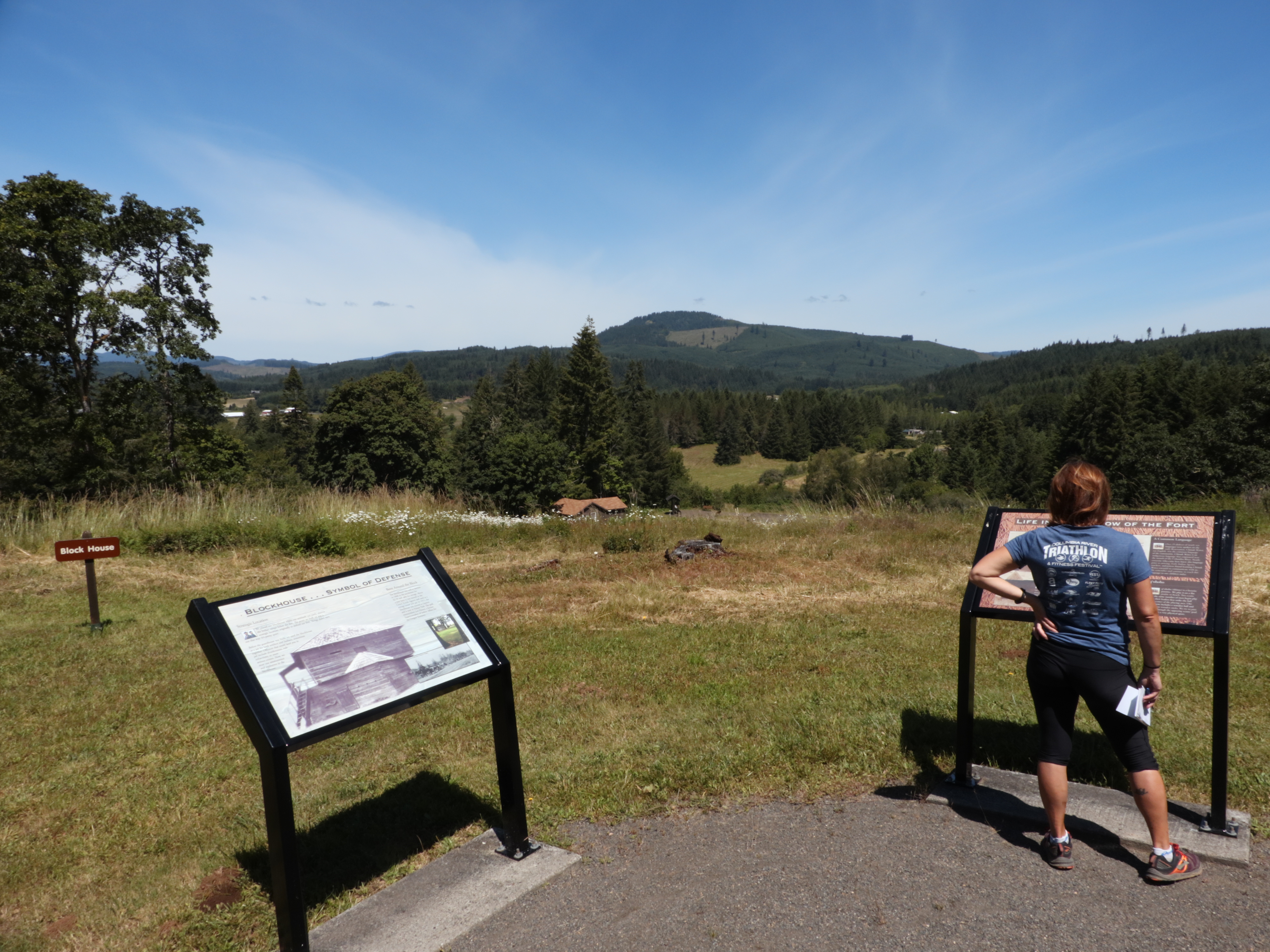
Fort Yamhill State Heritage Area Loop Hike: This .75-mile hike is a family-friendly trail with interpretive signage so visitors can learn more about the area’s history. Parking is free, and there are picnic tables and toilets at the start of the trailhead.
Fort Yamhill was originally established in 1856 to serve as a buffer between Oregon settlers and the Tribes and bands that would become the Confederated Tribes of Grand Ronde, and to keep Native people under military control.
There is a sentry box midway through the hike, near the old main road leading from the Willamette Valley to the coast, which marked the official entrance to the fort. From there, soldiers could observe anyone who entered or left the Grand Ronde Reservation. Near the Fort Yamhill park entrance are the Tribal plankhouse and uxyat Powwow Grounds, located en route to the hiking area.
Approximately the first quarter mile of the hike is a wide, shaded woodchip trail, followed by hard packed dirt without shade for the remaining portion.
Although none of the fort’s original structures remain intact, except a renovated officer’s quarters, interpretive signage explains the purpose of each area, along with excerpts from soldiers’ journals.
For more information, visit www.stateparks/oregon.gov and look for Fort Yamhill Heritage Area.